


이미 소장하고 있다면 판매해 보세요.
- 국내배송만 가능
- 해외 거래처 사정에 의하여 품절/지연 가능
- 도서 정보 중 미표기 사항 안내?
- 문화비소득공제 가능
책소개
목차
|
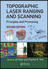
Preface to the Second Edition. Preface to the First Edition. Editors. Contributors. Introduction to Laser Ranging, Profiling, and Scanning. Terrestrial Laser Scanners. Airborne and Spaceborne Laser Profilers and Scanners.LiDAR Systems and Calibration. Pulsed Laser Altimeter Ranging Techniques and Implications for Terrain Mapping. Georeferencing Component of LiDAR Systems. Full-Waveform Analysis for Pulsed Laser Systems. Strip Adjustment. Accuracy, Quality Assurance, and Quality Control of Light Detection and Ranging Mapping. Data Management of Light Detection and Ranging. LiDAR Data Filtering and Digital Terrain Model Generation. Forest Inventory Using Laser Scanning. Integration of LiDAR and Photogrammetric Data: Triangulation and Orthorectification. Feature Extraction from Light Detection and Ranging Data in Urban Areas. Global Solutions to Building Segmentation and Reconstruction. Building and Road Extraction from LiDAR Data. Progressive Modeling of 3D Building Rooftops from Airborne LiDAR and Imagery. A Framework for Automated Construction of Building Models from Airborne LiDAR Measurements. Quality of Buildings Extracted from Airborne Laser Scanning Data-Results of an Empirical Investigation on 3D Building Reconstruction. Index. |
관련 분류
품목정보
- 발행일
- 2023년 01월 21일
- 쪽수, 무게, 크기
- 654쪽 | 1480g | 180*250mm
- ISBN13
- 9781032476292
사락 별점0
혜택 및 유의사항밑줄0
혜택 및 유의사항상품정보안내
(판형과 판수 등이 다양한 도서는 찾으시는 도서의 ISBN을 알려 주시면 보다 빠르고 정확한 안내가 가능합니다.)
해외거래처에서 품절인 경우, 2차 거래선을 통해 유럽과 미국 출판사로 직접 수입이 진행될 수 있습니다.
수입 진행 시점으로 부터 2~3주가 추가로 소요되며, 해외에서도 유통이 원활하지 않은 도서는 품절 안내가 지연될 수 있습니다.
해당 경우, 문자와 메일로 별도 안내를 드리고 있사오니 마이페이지에서 휴대전화번호와 메일주소를 다시 한번 확인해주시기 바랍니다.