
이미 소장하고 있다면 판매해 보세요.
- 국내배송만 가능
- 해외 거래처 사정에 의하여 품절/지연 가능
- 도서 정보 중 미표기 사항 안내?
- 문화비소득공제 가능
For Dummies
-
 Microsoft 365 Office All-in-One For Dummies 이동Microsoft 365 Office All-in-One For Dummies18% 55,740원
 -
Microsoft 365 Excel VBA Programming For Dummies 이동Microsoft 365 Excel VBA Programming For Dummies18% 48,770원
책소개
목차
|
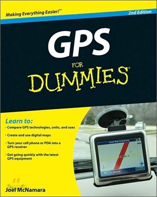
Introduction 1 Part I: All About Digital Maps 9 Chapter 1: Getting Started with Digital Maps 11 Chapter 2: Dissecting Maps 23 Part II: All About GPS 49 Chapter 3: GPS Fundamentals 51 Chapter 4: Grasping Important GPS Concepts 73 Chapter 5: Selecting and Getting Started with a Handheld GPS Receiver 87 Chapter 6: Automotive GPS Receivers 113 Chapter 7: Cellphones, PDAs, and Other GPS Devices 131 Chapter 8: Geocaching 155 Part III: Digital Mapping on Your Computer 179 Chapter 9: Digital Mapping Hardware Considerations 181 Chapter 10: Interfacing a GPS Receiver to a Computer 189 Chapter 11: Using GPS Manufacturer Software 207 Chapter 12: Finding Places and Coordinates 225 Chapter 13: On the Road with DeLorme Street Atlas USA 237 Chapter 14: On the Ground with TopoFusion 253 Chapter 15: From the Sky with Google Earth 269 Chapter 16: Creating and Using Digital Maps with OziExplorer 285 Part IV: Using Web-Hosted Mapping Services 299 Chapter 17: Saving and Editing Web Maps 301 Chapter 18: Navigating Web Road Maps 313 Chapter 19: Exploring Web Topographic Maps 327 Part V: The Part of Tens 339 Chapter 20: Ten Great GPS and Map Web Sites 341 Chapter 21: Ten Map Printing Tips 345 Chapter 22: Ten GPS Resources for Boaters 351 Index 361 |
저자 소개
Joel McNamara is a technology consultant and author. He first worked with LANDSAT satellite data during an earlier career as an archaeologist, and has used digital mapping and GPS in search-and-rescue missions, wild land firefighting, disaster response and planning, and outdoor recreation activities.
품목정보
- 발행일
- 2008년 10월 13일
- 쪽수, 무게, 크기
- 416쪽 | 185*234*28mm
- ISBN13
- 9780470156230
사락 별점0
혜택 및 유의사항밑줄0
혜택 및 유의사항상품정보안내
직수입외서의 경우, 해외거래처에서 제공하는 정보가 부족하여 제목, 표지, 가격, 유통상태 등의 정보가 미비하거나 변경되는 경우가 있습니다. 정확한 확인을 원하시는 경우, 일대일 상담으로 문의하여 주시면 답변 드리겠습니다.
(판형과 판수 등이 다양한 도서는 찾으시는 도서의 ISBN을 알려 주시면 보다 빠르고 정확한 안내가 가능합니다.)
해외거래처에서 품절인 경우, 2차 거래선을 통해 유럽과 미국 출판사로 직접 수입이 진행될 수 있습니다.
수입 진행 시점으로 부터 2~3주가 추가로 소요되며, 해외에서도 유통이 원활하지 않은 도서는 품절 안내가 지연될 수 있습니다.
해당 경우, 문자와 메일로 별도 안내를 드리고 있사오니 마이페이지에서 휴대전화번호와 메일주소를 다시 한번 확인해주시기 바랍니다.
(판형과 판수 등이 다양한 도서는 찾으시는 도서의 ISBN을 알려 주시면 보다 빠르고 정확한 안내가 가능합니다.)
해외거래처에서 품절인 경우, 2차 거래선을 통해 유럽과 미국 출판사로 직접 수입이 진행될 수 있습니다.
수입 진행 시점으로 부터 2~3주가 추가로 소요되며, 해외에서도 유통이 원활하지 않은 도서는 품절 안내가 지연될 수 있습니다.
해당 경우, 문자와 메일로 별도 안내를 드리고 있사오니 마이페이지에서 휴대전화번호와 메일주소를 다시 한번 확인해주시기 바랍니다.
37,620원
총 1개
37,620원